Treeton Dyke


View Treeton Dyke in a larger map

Habitat

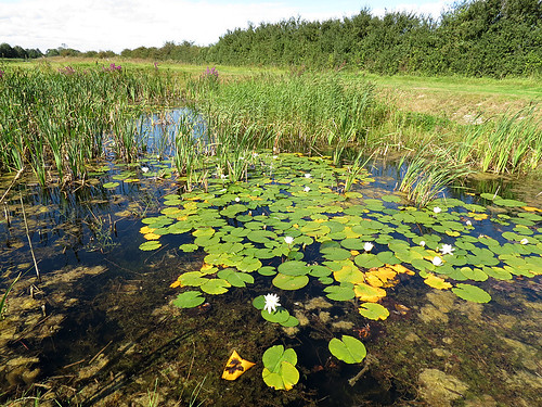
Large Lake with surrounding meadow and scrubland.

Access

Park at the end of Washfield Lane, Treeton, near the railway line. Follow path south along the edge of the Railway to reach Treeton Dyke.

More Information

OS Map from BING Maps

Species List

Nosterfield Local Nature Reserve


View Nosterfield LNR in a larger map

Habitat

A former sand and gravel quarry, owned and managed by the Lower Ure Conservation Trust since 1996. Primarily a wetland, grassland habitat, with four permanent bodies of water, the dragonfly population is continually expanding. To date, 16 species have been recorded, most recently Emerald Damselfly and Four-spotted Chaser. A permissive footpath from the main car park runs in one direction to West Tanfield village, and in the opposite direction towards Nosterfield village, from which it is possible to view the Silt Lagoons. Two hides overlook the Main Lake and a viewing screen overlooks the North Lake. In summer, the footpath is a favoured ‘sunning’ area for Black-tailed Skimmers and in the autumn is frequented by Migrant Hawkers and Common Darters.

Access

Access is from the B6267 (Moor Lane), east of West Tanfield, which follows the boundary of the reserve, signed at the car park entrance (SE278795).

The site is open all year round but visitors are requested to keep to the permissive footpath at all times.  To arrange a group visit, please contact Simon Warwick, LUCT Trustee: email simon@luct.org.uk or telephone 01765 602832

More Information

OS Map from BING maps

Species List

Potteric Carr


View Potteric Carr in a larger map

Habitat

Range of open water, marsh and woodland.

Access

Located half a mile from Junction 3 of the M18, just south of Doncaster. Access into the reserve is via Sedum House, the head office of the BTCV.

More Information

OS Map from BING Maps
Potteric Carr – YWT

Species List

Spurn Point

Habitat

Shallow scrapes and former canal.

Access

Park in the Canal Scrape car park before the entrance to Spurn Point.

More Information

OS Map from BING Maps

Species List

North Cave Wetlands

Habitat

Former site of sand and gravel extraction turned back to nature. A Yorkshire Wildlife Trust Site – The site is still being developed, primarily for birds. A series of five ponds have been created for dragonflies along the northern path of the reserve.

Access

Leave the M62 at junction 38. Reserve is signposted from North Cave village. Reserve is also signposted from the A1079 at Market Weighton.

More Information

Market Weighton Canal Trail
OS Map from BING Maps
North Cave Wetlands
North Cave Wetlands -YWT

Species List

Lilly Pond
Lilly Pond


Hornsea Mere


View Hornsea Mere in a larger map

Habitat

Large shallow natural lake close to the coast.

Access

Parking at Kirkholme Point at (TA193470).

More Information

OS Map from BING Maps

Species List

Filey Dams


View Filey Dams in a larger map

Habitat

A Yorkshire Wildlife Trust site consisting of fresh marsh.

Access

Accessed via Wharfedale road off the A1039.

More Information

OS Map from BING Maps

Filey Dams – YWT

Species List