Potteric Carr


View Potteric Carr in a larger map
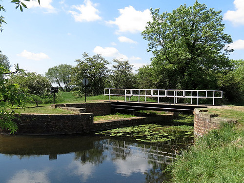
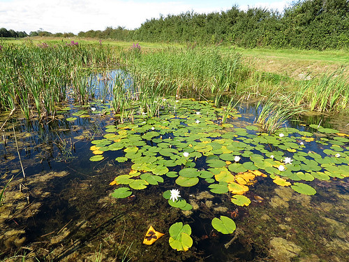
Habitat

Range of open water, marsh and woodland.

Access

Located half a mile from Junction 3 of the M18, just south of Doncaster. Access into the reserve is via Sedum House, the head office of the BTCV.

More Information

OS Map from BING Maps
Potteric Carr – YWT

Species List

Spurn Point

Habitat

Shallow scrapes and former canal.

Access

Park in the Canal Scrape car park before the entrance to Spurn Point.

More Information

OS Map from BING Maps

Species List

River Hertford


View River Hertord in a larger map

Habitat

Canalised river draining into the River Derwent.

Access

Car park just north of the bridge over the A64 and also the bridge at Folkton Carr.

More Information

OS Map from BING Maps

Species List

Pocklington Canal


View Pocklington Canal in a larger map

Habitat

Slow flowing fresh water of high quality with plenty of floating and emergent vegetation.

Access

Access is possible from a number of locations along the canal.

More Information

OS Map from BING Maps

Species List

Pocklington Canal, Bielby
Pocklington Canal


North Cave Wetlands

Habitat

Former site of sand and gravel extraction turned back to nature. A Yorkshire Wildlife Trust Site – The site is still being developed, primarily for birds. A series of five ponds have been created for dragonflies along the northern path of the reserve.

Access

Leave the M62 at junction 38. Reserve is signposted from North Cave village. Reserve is also signposted from the A1079 at Market Weighton.

More Information

Market Weighton Canal Trail
OS Map from BING Maps
North Cave Wetlands
North Cave Wetlands -YWT

Species List

Lilly Pond
Lilly Pond


Market Weighton Canal and Newport Ponds


View Newport Ponds and Market Weighton Canal in a larger map

Habitat

Canal and ponds complex with floating vegetation.

Access

A car park can be found along Canal Side West off the B1230 in Newport Village.

More Information

Market Weighton Canal Trail

OS Map from BING Maps

Species List

Filey Dams


View Filey Dams in a larger map

Habitat

A Yorkshire Wildlife Trust site consisting of fresh marsh.

Access

Accessed via Wharfedale road off the A1039.

More Information

OS Map from BING Maps

Filey Dams – YWT

Species List

Tophill Low Nature Reserve


View Tophill Low in a larger map

Habitat

A wide range of freshwater habitats including marsh, lagoons, dykes and small ponds.

Access

From the A164 Beverley to Driffield Road. Leave the A164 at Watton, sign posted Tophill Low Pumping Station and follow the brown tourist signs along unclassified road for 6.5km/4 miles. Turn right at the main gates and follow the road round to the car park. Open Wednesday to Sunday 9am – 6pm during the summer months, and 9am – 4pm during the winter. The reserve is normally closed Mondays and Tuesdays, but is open on Bank Holiday Mondays.

More Information

OS Map from BING Maps
Tophill Low Nature Reserve

Species List