Skipwith Common


View Skipwith Common in a larger map
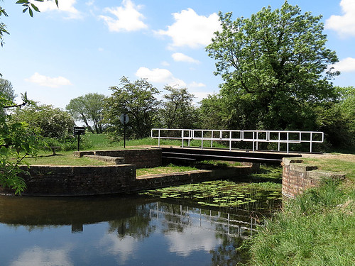
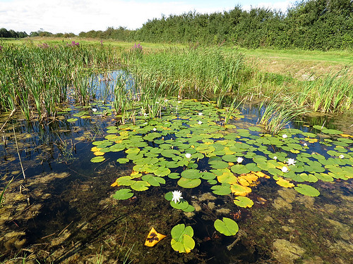
Habitat

Dry and wet heathland, mire bogs.

Access

From the west off the A19 along King Rudding Lane, the east from Common Lane in Skipwith.

More Information

OS Map from BING Maps

Species List

Saltmarshe Delph


View Saltmarshe Delph in a larger map

Habitat

A Yorkshire Wildlife Trust Site – Open fresh water and reedbed.

Access

South of Howden (SE774248).

More Information

OS Map from BING Maps
Saltmarshe Delph – YWT

Species List

Pulfin and High Eske Nature Reserve


View Pulfin and High Eske NR in a larger map

Habitat

A Yorkshire Wildlife Trust site consisting of High Eske borrow pit and Pulfin reed fen.

Access

Accessed via Tickton by walking along the River Hull bank (TA050440).

More Information

OS Map from BING Maps
Pulfin Bog – YWT

Species List

Pocklington Canal


View Pocklington Canal in a larger map

Habitat

Slow flowing fresh water of high quality with plenty of floating and emergent vegetation.

Access

Access is possible from a number of locations along the canal.

More Information

OS Map from BING Maps

Species List

Pocklington Canal, Bielby
Pocklington Canal


Oak Road Lake, Hull


View Oak Road Lake, Hull in a larger map

Habitat

Borrow pit formed by extraction to strengthen the banks of the River Hull.

Access

From Beverley Road, Hull via Beresford Avenue (TA092322).

Species List

North Cave Wetlands

Habitat

Former site of sand and gravel extraction turned back to nature. A Yorkshire Wildlife Trust Site – The site is still being developed, primarily for birds. A series of five ponds have been created for dragonflies along the northern path of the reserve.

Access

Leave the M62 at junction 38. Reserve is signposted from North Cave village. Reserve is also signposted from the A1079 at Market Weighton.

More Information

Market Weighton Canal Trail
OS Map from BING Maps
North Cave Wetlands
North Cave Wetlands -YWT

Species List

Lilly Pond
Lilly Pond


Leven Canal


View Leven Canal in a larger map

Habitat

Former canal now designated as an SSSI. Fed by calcareous spring water of high quality and supporting a range of fenland plant species along its margin

Access

Off the Beverley to Bridlington Road A1035 in Leven (TA1045).

More Information

OS Map from BING Maps

Species List

Hornsea Mere


View Hornsea Mere in a larger map

Habitat

Large shallow natural lake close to the coast.

Access

Parking at Kirkholme Point at (TA193470).

More Information

OS Map from BING Maps

Species List

Filey Dams


View Filey Dams in a larger map

Habitat

A Yorkshire Wildlife Trust site consisting of fresh marsh.

Access

Accessed via Wharfedale road off the A1039.

More Information

OS Map from BING Maps

Filey Dams – YWT

Species List

Eastrington Ponds


View Eastrington Ponds in a larger map

Habitat

Local Nature Reserve at (SE7829). The main pond is the former site of Eastrington Brick Works. There are several borrow pits foound along either side of the railtrail, the pits the result of building the former Hull and Barnsley Railway.

Access

There is a car park which is accessed off Howden Road, west of Eastrington village.

More Information

OS Map from BING Maps
A plan of the site can be downloaded from East Riding of Yorkshire Council’s website.

Species List